Day 34 - Carne Beach to Treveague Farm via Dodman Point – 10 miles
I woke up in my new camp site tired despite having the day off from walking and cycling yesterday. I would have thought it would have refreshed me a little bit but apparently not. I was still a bit sore from too much sun and I’m not sure my face will ever recover! Lol!
I got up and showered and had some breakfast of seeded rolls that I'd bought in Tesco from Truro the other day, with some cheese that I'd bought from home and kept unopened so it was still ok, and some cherry tomatoes. I made up the rest as well for a packed lunch today, as the planned walk from Carne Beach where I'd finished on Tuesday, back to the camp site looked a little remote. Also saving the pennies as much as I can!
I was ready to go by 8.45am and set off. It was odd not having the bike on the rack on the back of the car, though I made sure that I'd put the rack inside or I wouldn't be able to get the bike back when I'd cycled from the campsite to Carne Beach during the afternoon.
I arrived at Carne Beach at about 9.15am. The earliest start to a day's walking so far this holiday. The drive over there had of course looked horribly hilly so the cycle would be a bit of a trauma later on after a long day's walking. Oh well! I am sort of in the routine of it all now I guess? All this exercise will at least be ok for catching up my fitness levels for this summer!
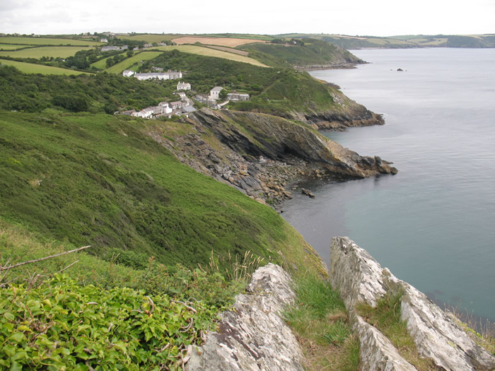
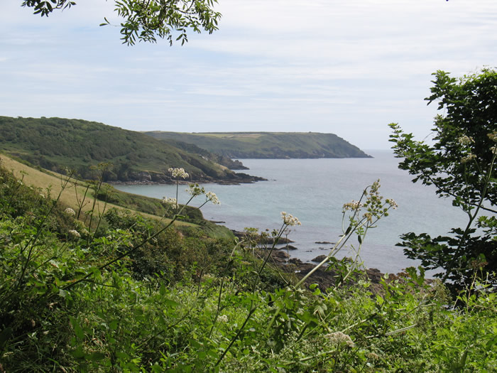
A fingerpost sign after the bend in the lane informed me that Nare Head was a mile away. The walk out there was very pleasant and the climb up was fairly gradual on the whole. The path didn't seem to go right out to the very point, but as I rounded the end Gull Rock and the other small rocks that I'd seen on the previous day's walking came into view. I could also, for most of the walk today, look south west right across to Lowland Point which I had rounded on my first day of walking this year. It seemed an awfully long way away. As I stared out at the very unoriginally named Gull Rock I wondered how many little islands of the same name I had passed by on the whole way so far from Minehead!? A good few I'm sure! Maybe I'll count them on the map at some bored moment!
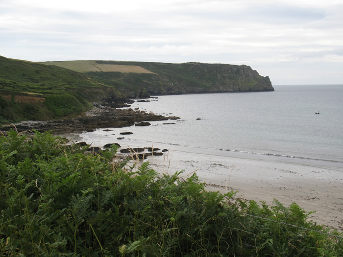
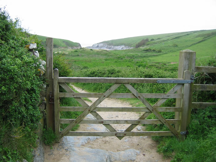
Nare Head after climbing steps up from the lane at Carne Beach to join the coast path.

I approach the small headland of Pennarin Point, with Nare Head still behind.

Above Pennarin Point looking across the small inlet of Tregagle's Hole towards Nare Head.

Looking back at Pennarin Point back towards Carne Beach behind as I begin the walk out to Nare Head proper.

Gull Rock from the end of Nare Head.
The coastline ahead looked rugged and the day turned out to be quite a traumatic one on the legs as this was certainly the must up and down day of the walk this year by a good way! The first cove after Nare Head was Kiberick Cove and it was very beautiful as were lots of the rocky inlets all along this section. Thankfully the sun was hiding behind high cloud though it looked so high and thin that I anticipated it evaporating away throughout the morning. Thankfully it seemed to hold for most of the morning. How mad... hoping the sun DOESN'T shine on a walking holiday! I'd actually woken up this morning with sunlight shining on the tent briefly and thought Oh NO! Hehe. I was definitely wishing that I'd bought my sun hat and some sun block as my nose will be chargrilled if the sun keeps shining! LOL!

The first bay after Nare Head is Kiberick Cove with Blouth Point on its far side.

Looking back along the edge of Nare Head to gull Rock from behind Kiberick Cove.
Similar view from further round the back of Kiberick Cove.

I round The Blouth to see the next headland of Manare Point, beyond The Straythe. Beyond that is Caragloose Point.
I rounded the back of Kiberick Cove and headed out onto the next headland of The Blouth. At its end I got a vista looking along a series of headlands, and still a long way off the ultimate aim of todays walk Dodman Point. It was yet another steep climb down to just above the rocks of the Straythe. The water was gurgling gently against the rocks. There was a long drawn out climb back out of the bay up to Broom Parc. I met the first person I'd seen all day as I zig zagged my way upwards. Following on behind was her husband, who seemed the least fit of the two. The woman was seeming to think they could carry on all day and end up in PortScatho, and they'd started in Veryan, heading out to portloe and then looping back along the coast path? Good luck to them is all I can say. My legs were tired on the ups today and I was sweating buckets despite the thin and thankfully persisting thin cloud cover. At least the day off from walking had helped the blister on my toe, which wasn't playing up at all today.
Looking along the back of the inlet of The Straythe, with Broom Parc the building visible on the cliffs half way along.

Parc Caragloose Rock and Cove as I descend to the back of The Straythe.

The path goes low behind The Straythe before climbing out to Broom Parc. In the distance is Dodman Point around which I have to walk today.

Looking back across the Straythe to Gull Rock on the climb up to Broom Parc.
Looking back over the Straythe to Gull Rock on the walk out onto the next headland of Manare Point.
As I reached Broom Parc the path onwards was fairly flattish out to Manare Point. The views were truly beautiful and I kept snapping away all the time. The only problem with the lack of sun was that the blues and turquoises of the crystal clear waters were subdued, but a small price to pay for keeping a nose!:)
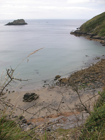
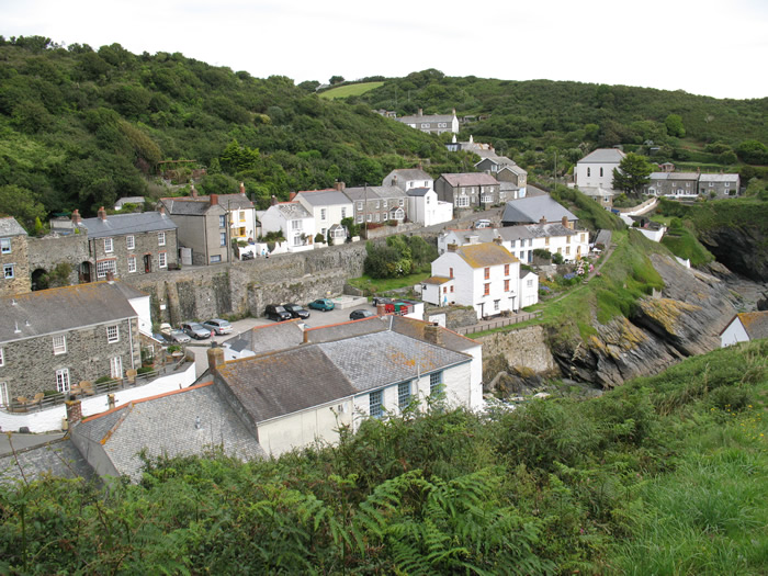
I rounded Manare Point and got my first view of Portloe tucked in behind Jacka Point in a tiny valley. A truly picture postcard little fishing hamlet. I sat on some beautifully placed craggy rocks looking out across the scene and sent a phone postcard to Choky and Steve. I decided to have a little rest there and ate a cheese and tomato roll and some diet coke. While sitting there I watched a bus struggle to pass a van in the hamlet far below. It's bad enough driving a car through these tiny winding lanes I would hate to have to have to drive a bus down them! An elderly couple came up from Portloe as I sat there. The woman commented that I'd got a grand spot there, but in truth its hard to find a none grand spot on this part of the walk!
Looking down at Portloe tucked in behind Jacka Point from my 'grand spot'
Having rested a while I set off downhill pretty much all the way to Portloe. It was atruly marvellous place, lots of tiny cottages all packed into two small valleys. There was even a tiny protective harbour wall. I made it to the lane, having taken a wrong turning and not going out around Jacka Point. I turned right up the 'main' street and then at a signpost turned right again, seemingly down people's drives and private agrden footpaths. There were steep steps up to a flagpost lookout which I didn't go out onto to have a look. There was lots more climbing to be done afterwards. Ups and downs all the way past Hartriza Point and caragloose Point. I passed another favourite named rock Shag Rock... how many of those have there been so far on this walk as well!?
Final approach to Portloe as I walk down Jacka Point
The tiny harbour at Portloe, as I climb up the steps towards the flagpost lookout.

Looking back at Jacka Point, Manare Point, Gull Rock and very distantly Black Head near Manacle Point

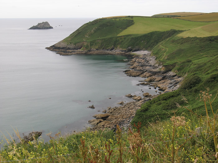
And the way ahead from Hartriza Point. Close at hand is Caragloose Point with Shag Rock. Dodman Point, the rounding of which is the end of the day's walk, is still a very long way off!

Looking back at Hartriza Point from Caragloose Point.

Looking back at Caragloose Point and all the way back to Nare Head.
I caught up with and elderly couple who I'd watched climb up out of Portloe on the steps to the Flag post lookout while perching on my rock and eating my roll. They were a lovely pair who were saying it was much more up and down around here than they remembered when they had done it before. They had started out in Portloe and were going as far as Portholland. They seemed impressed that I had come from Carne Beach and planned to go right around the back of Dodman Point before finishing. Cycling back afterwards seemed even more impressive to them. I guess it IS quite impressive! Lol!
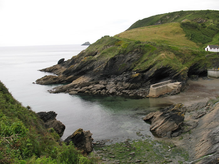
Just before West Portholland there was a path turn inland and uphill before a more gradual descent all the way to the hamlet of about two houses and a chapel.. now a house. I decided to cut across the beach to East Portholland. Nice to get the boots on the sand and the rocks for the first time today.
There was a makeshift cafe in a row of houses overlooking the beach at East Portholland. Basically it consisted of a stable door affair and a bell. A couple who seemed standoffish, who I had been leapfrogging with since the climb out of Portloe got there first and rang the bell. Unfortunately there was no diet drink of any kind so I settled for a full sugar coke. It would give me more energy for the more strenuous than imagined day anyway!
The sun was breaking through all over the place by this point.. not something I should be complaining about really but hey ho. I put up an umbrella on one of the tables and sat in its shade while I downed the can and then set off again.
East and West Portholland come into view ahead after rounding Caragloose Point and walking along Tregenna Cliffs.

Looking back along Tregenna Cliffs towards Caragloose Point.

At last West Portholland is close at hand and in the next inlet the larger East Portholland is visible.

Looking back across the beach from my under umbrella shade, full sugar coke spot in East Portholland.
Of course it was another climb up out of East Portholland, but after that it was fairly flat and fairly tree covered so I had some shade at least. At a gate the path turned sharply seawards and downhill and then after a while turned inland again to join a deep cut tree shaded lane, hewn out of the rock and heading downhill towards Porthluney Cove. After a bend at the bottom Caerhays Castle came into view looking behind. A very impressive building and home of the Williams family. It was a very grand crenulated mock Castle complete with turrets etc. Victorian I would say?
I carried on down the lane at the back of the beach and then cut across to the beach cafe through a gate. I bought two bottles of ice cold diet coke, a bag of cheese and onion crisps and a Solero ice cream! Splurge or what. I moved one of the chairs into the shade and sat there for a while before walking back over to the lane and turning right along it. A fingerpost sign soon pointed off to the right, uphill across grassy fields with good views back across the beach and the castle behind.
I overtook a couple I'd watched set off while I was eating my ice cream back at the beach cafe and the path then entered woodland and more shade. The climb through the woods was quite steep but it was stepped all the way and for once the steps were at the right height and distance for my stride so progress was fairly quick for a change.
The path from this point was a little more level. Still up and down but nothing like it had been earlier on! Dodman Point was looking much nearer at this point which I was grateful for as I was considerably tireder than I ever imagined I would be after not a huge day of walking after a day of rest. I hadn't anticipated the rugged nature of the ascents and descents before setting off though. My blistered foot was beginning to get a bit sore again into the bargain so not great all in all.
After climbing up out of East Portholland Greeb Point, the next headlands beyond the inlet of Porthluney come into view

I approach the inlet at Porthluney

The beach at Porthluney after walking down the shaded tunnel of a lane.

The shadey lane down to the back of Porthluney Beach.

Caerhays Castle behind me as I start to walk along the lane behind the beach.

Looking back across Porthluney Cove to Caerhays Castle as I climb out of the valley.

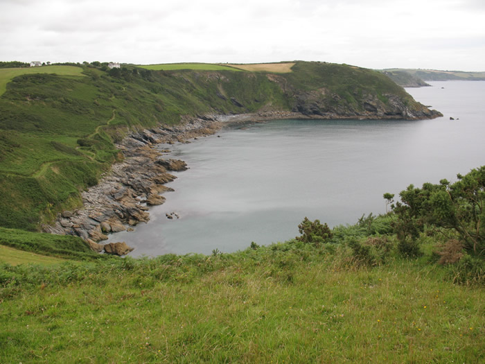
The jagged spine of rock between me and Hemmick Beach. At last Dodman Point is looking nearer, but I still have to walk all the way around it to reach the campsite without cheating!
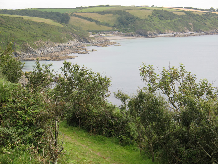
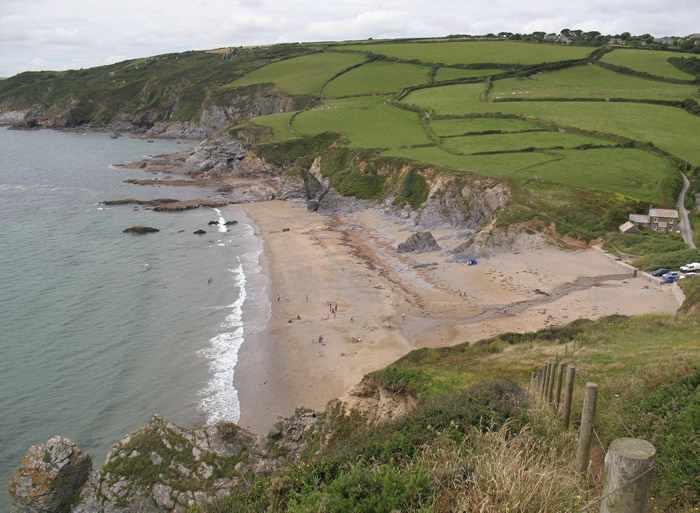
I descended to Hemmick Beach which was quite busy now the sun was shining more than hiding! It was tempting to head up the lane to the campsite from here, but I had promised myself to go all the way around Dodman Point and to the campsite the long way round. That would mean that tomorrow I could start the day's walk from Gorran Haven as I'd actually done the coast path from the campsite around to there on my day off. I still needed to do Dodman Point though as I didn't want to cheat and miss it out altogether. I joined the lane behind Hemmick Beach heading down before taking a path fingerposted around to Gorran Haven as being 3 and a half miles. I would be doing about 2 of those or more back to the campsite itself.
The first climb was quite steep but I'd seen on the way down the other side that it looked fairly level around the point after that. It was indeed until around the first small headland and then there was more climbing involved but hey ho. I sat for another roll and lots of the still cool diet coke from Porthluney beach shop while sitting on a handy bench after the climb. The sun was again hiding behind cloud at this point thankfully. I could see the whole of the day's walk looking across the bay to Nare Head. In the far distance I could see Black Head and Lowland Point again... not far from the start of this year's walk in Coverack.

I approach Hemmick Beach at last.

Looking back all the way to Nare Head that I'd rounded first thing this morning, from my final approach to Hemmick Beach.
Looking back down at Hemmick Beach as I begin my climb up to go around Dodman Point.
After having a rest I set off again and made it to the large stone cross on the end of Dodman Point before heading around the far side of the point again. Before too long Vault Beach came into view. There were a few people down there but it was pretty much deserted compared to the day before. I cut up to the lane and turned right along it heading towards the top gate of the campsite.

The large stone cross at the end of Dodman Point. Far in the distance, Black Head near the beginning of this years walk, 5 days ago.

Vault Beach comes into view after rounding the end of Dodman Point.
I made it back to the bike at 3.40pm so not bad really.. having done 10 miles of considerably up and down walking. I had set off earlier than usual this morning though from Carne Bay.
I wouldn't have wanted to do any more walking at all today but the cycling uses different muscles and more importantly at least you are sitting down for a while!! AS I knew it would be from the drive over there this morning it was a pretty hilly ride today, but I only got off the bike to walk up one long hill signposted as 1 in 5. And i got up a fair bit of that too! I was using the whole of my gear range all the way though, so pretty pathetic really, but hey I had walked 10 miles already!! give me a break! My route went from the campsite, through Trevarrick, Tubbs Mill, Tippetts Shop towards Veryan but turning off left before getting there to head for Carne Village itself and then down to the beach. I arrived there at about 5pm so about an hour and quarter's cycle and 9.5 miles of up and downhill.
I drove back to the campsite, had a shower, bought some crisps and flapjack from the shop for tea and then headed to the kitchen and utility room to type this up on the mains to save the battery and charge my phone at the same time!
For the rest of the evening I read, looked at maps and generally relaxed, planning the route for tomorrow!
Map of the day's walk:(click to enlarge)

Comments
Post a Comment