Day 30 - Coverack to Helford - 12 Miles
Well the day dawned not too bad weatherwise though it had been really chilly during the night. I was glad that I had decided to put my second sleeping bag over the top of me in the other one as a sort of blanket. I wasn't cold under those, but I wouldn't have wanted to get out from underneath I can tell you!
I was awake earlyish and had woken myself up throughout the night being paranoid about snoring so as soon as I did I was awake. I wanted the loo slightly but managed to doze until about 7.30am. Early for a sunday but not tooooo early for camping.
I had a breakfast of orange juice and salmon and cucumber baguette. Using up stuff that would go off in the fridge at home. I made the other half of the baguette the same for a packed lunch.
I was showered and ready to go by about 8.45am and so set off with the bike on the back of the car. I was expecting the journey not to take too long but the twisty and narrow lanes in this part of the world that I decided to use to get to Helford made it a long journey to say the least. It was a really LOVELY trip over there though, through tiny villages and around the end of the Helford river and its various inlets which were all muddy as the tide was out. The wooded lanes were beautiful... deep green shadows and dappled sunlight.
I got to the car park at Helford and chained the bike up to a fence and then set off for Coverack where I'd finished the walk last year. The journey through the twisting lanes, only as wide as the car and hedges three times higher in places, was lovely but rather worrying as the roads were severly up hill and down dale. I began to rather worry about the cycle home after what would be a long first day of walking! hey ho! Cross that bridge when I come to it! The journey had taken forever when I arrived and the car park ticket said 10am when I got it out of the machine and stuck it to the windscreen.
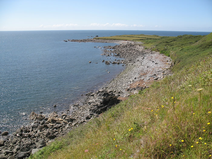
I set off down the hill and then turned left down a small lane heading out towards Lowland Point. The sun was shining beautifully now and white fluffy clouds were overhead giving shade from time to time. Out to sea it was clearer. It was a pleasant walk out to the point. Quite flat with no steep gradients which was good, as I was quite tired and not practiced at walking at all this year! I was slightly concerned that I had bitten off more than I could chew for my first day when in this state of unfitness. Time would tell.
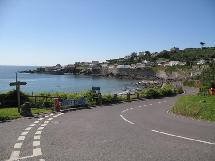
Back in Coverack, where I got to last year. I turn right down a land leading out towards Lowland Point

Path out to Lowland Point from Coverack
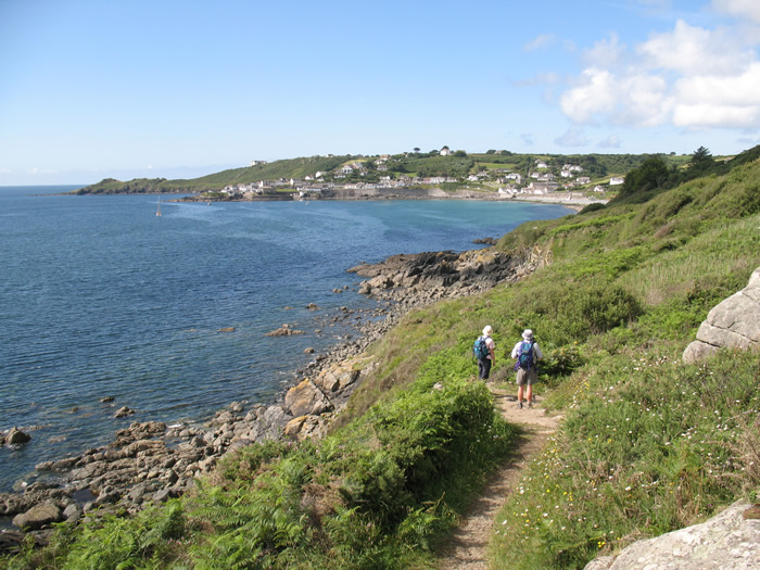
Looking back to Coverack on the way out to Lowland Point. Across the bay is Chynalls Point that I'd passed last year.
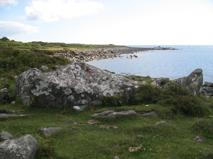
I finally near the end of Lowland Point
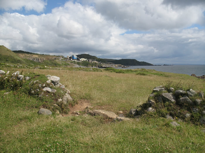
As I rounded the point Dean Quarry came into view, which was a bit of an eye sore, but interesting enough in its own way. In a small bay at the end of the point I spotted a seal bobbing about in the water, but when he saw me he was gone. I continued onwards. There was a slight climb up through the quarry workings. I am not sure if the quarry is still working.. parts of it looked very derelict, but whatever the case all was quiet today, though that could have been due to it being a sunday? It was quite interesting seeing all the workings of the quarry at close quarters. It would have been even more interesting seeing the conveyor belts that delivered crushed gabbro to waiting tankers at the jetty up until 2005 according to an information board I had seen at the end of Lowland Point.
Dean Quarry comes into view as I round Lowland Point
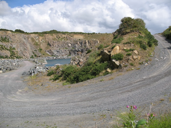
Quarry workings at Dean Quarry
Looking back at Lowland Point from Dean Quarry
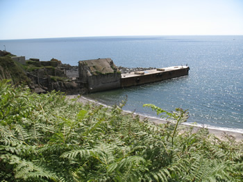
The Jetty used for loading tankers with Gabbro at Dean Quarry until 2005

Looking back at Lowland Point after the climb up to Dean Quarry

Dean Quarry
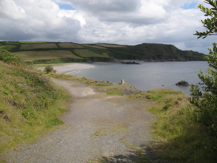
The path was very well signposted around and through the quarry buildings and then descended to a nice looking grit, pebbly and sandy beach at Godrevy Cove. There were a few people braving the intermittent chilly shadows as clouds drifted across. I sat there for a short while and had a packet of crisps and some diet coke. A group of older walkers who had been shadowing me since Coverack overtook me as I sat there.
The descent to Godrevy Cove from Dean Quarry.
I set off not long after them and climbed up the valley behind the beach alongside a babbling brook which was very pleasant. The climb was very gentle and ended up in a tiny hamlet called Rosenithon. At the 'main' road we all turned left and I followed the small group up the lane gently to the point where the coastal path turned left off the lane to cross fields to Porthoustock. The small group of older walkers carried on along the lane for some reason? It was easy walking across the fields because it had all been cut and lined up in rows for hay.
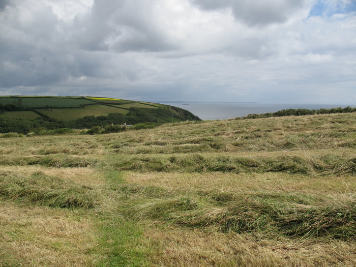
The path across the hay field to Porthoustock
I arrived at the small bay of Porthoustock which had obviously been a quarry village as well at some point in the past as there were large concrete structures built all around the harbour area. I stopped for a brief sit down to check the map and have a quick drink before tackling the climb up out of the village. As I sat there a couple who turned out to be Germans carrying large rucksacks on their backs.. doing it the hard way passed me by. I put the map away and followed them up the lane. The map seemed to be saying that the path followed the lane for a while, but a new route turned off left/straight on in front of some quaint cottages and then up a steep grassy field to rejoin the lane further up. From there we followed the lane climbing gradually until a junction. At this point there was a path straight opposite that was a dark tunnel, seemingly down the middle of a thick hedge. This continued for ages until we emerged at what had been a farm, but now seemed to be a barn conversion amongst an old orchard of apple trees etc. I passed the Germans at this point and turned right at the lane all the way down to Porthallow.

I arrive in the tiny hamlet of Porthoustock.

Rural Cornwall and the church spire of St Keverne as I climb up out of Porthoustock
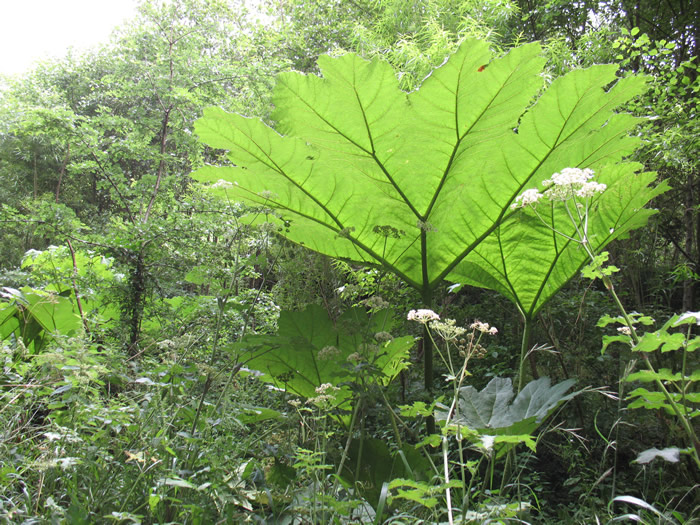
Giant plants near Porthallow.
There was a small pub there.. The Five Pilchards... so I decided, as it had just gone midday, to stop and have a half pint of Stella, which was cloudy and tasted a bit peculiar. The bar man was a bit weird too. I took my half pint out the front to sit on a bench I had spied as the bar was deserted. The bar man came to the front door with his dulux dog to check on where I had taken the glass I think? A woman came out too and they spent the rest of the time I was there talking in Spanish?? I decided to eat my salmon and cucumber baguette lunch. Maybe that's why the owners were jabbering in Spanish?
As I finished my lunch and my half pint the small group of walkers who had continued on along the lane rather than cut across the fields to Porthoustock turned up. I set off across the back of the car park and a finger post pointed up some steps by the side of a cottage, telling me that Flushing was three miles away. The walk around to Nare Point seemed to go very quickly and was pretty pleasant apart from a short stretch across a grassy hill which meant that my ankles were twisting slightly with each step because of the slope of the hill.

I climb up out of Porthallow.
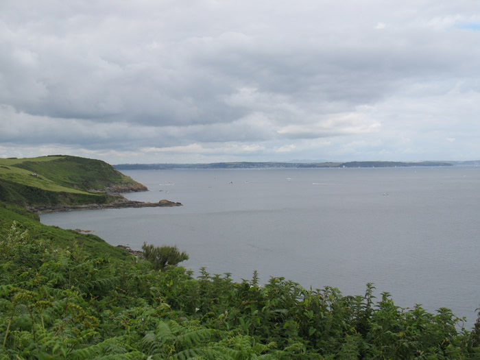
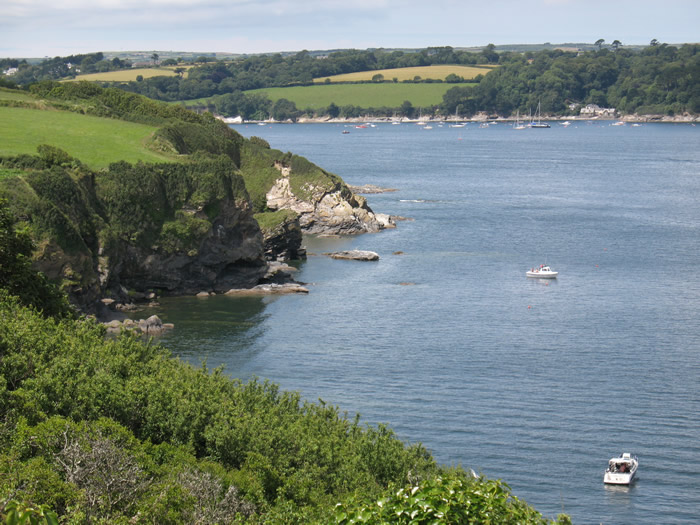
Nare Head after Porthallow. A long way across the bay is Falmouth, the end of tomorrow's walk.

Nearer to Nare Head.

Looking back towards Porthallow as I near Nare Point
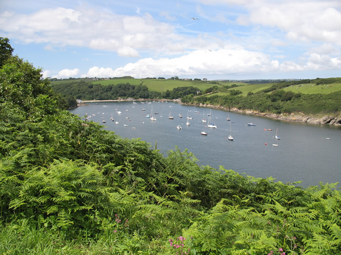
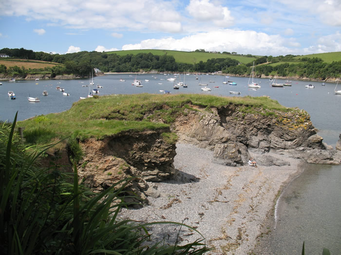
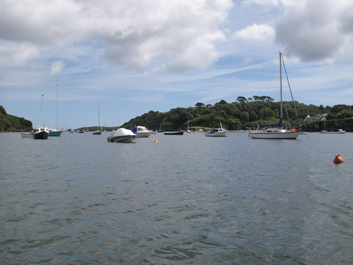
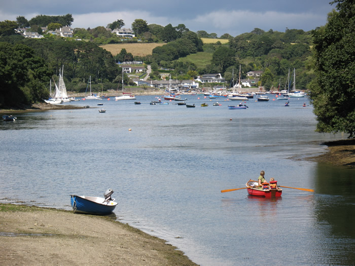
On the very end of the point was a life guard look out building. I didn't go right out to it and rejoined the path below heading left. There was a lovely new vista to look at here. Looking across The Helford River to tomorrow's walk, all the way to Falmouth. Closer at hand was the mouth of Flushing Creek which I knew that I would either have to cross or walk all the way around. The tide was in so I was thinking I might have to walk around, though I’d overheard one of the older walking group talking about a boat across? I decided not to worry until I got there and see what happened. And I was seriously enjoying the beauty of this part of the walk especially with the sun being out and all the sailing boats bobbing about in the water out there. The walk along to Gillan Harbour just got better and better. There were lovely little beaches periodically and rocky outcrops between. It had a real oldy worldy feel with no traffic and no real hordes of tourists. It just seemed like local families and local children playing in the water's edge.

Nare Point at the mouth of the Helford River with its Coastguard lookout.
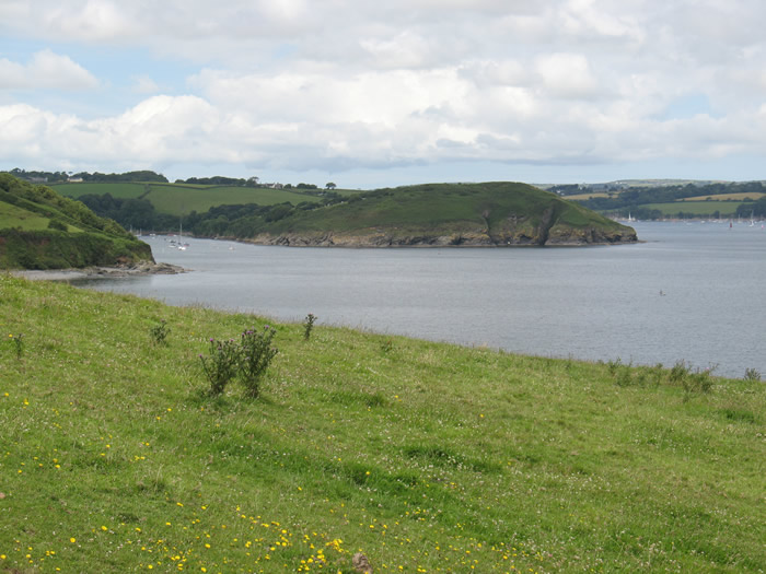
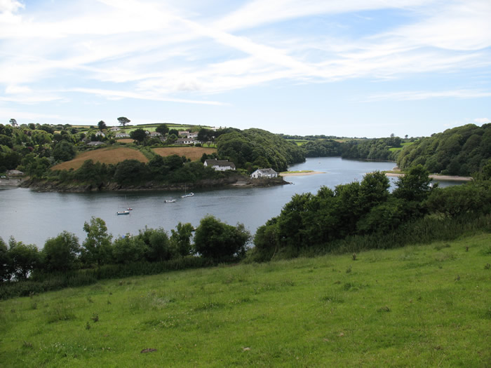
Flushing Creek on the left and The Helford River on the right with Dennis Head between

Old gate down to a private slipway and beach as I start to walk along the south side of Helford River.
Flushing Creek filled with water. St Anthony Church tower just visible on the far side.
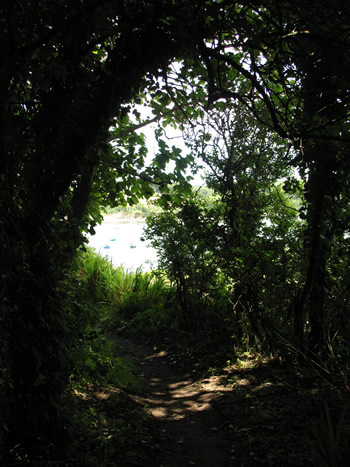
Deeply shaded paths with dappled sunlight as I approach Gillan Harbour.
Rocks at Gillan Harbour
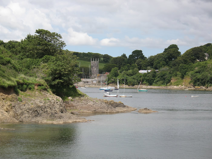
St Anthony Church across Flushing Creek from Gillan Harbour
Across the water was the church of St Anthony's nestling behind the headland of Dennis Head across the creek. At Flushing I ignored a sign for the alternative inland route along the lanes around the end of the creek and then back out towards St Anthony. I thought I would carry on down to the water to see what the possibilities were. It was obvious that the stepping stones mentioned on the sign to cross the creek would be very submerged as it was just about high tide. I wandered along the beach to the narrowest part of the creek. People were swimming in it. I wondered if it would be possible to strip down to my pants and wade across. An older couple had arrived just before me and were looking about for a boat. I had a chat with them and they had a guide book. in it was a number you could call to ask for a boat across the creek. I took out my mobile expecting there to be no signal at all but was amazed to see a few bars of a signal. I rang and the bloke at the other end said he would organise it straight away. I put the phone down and then realised I hadn't said where exactly we were. We just stood around looking helpless and after a short while a young lad in a flat bottomed boat headed over from St Anthony's and landed on the beach at our side. It was great to actually be out on the water rather than looking out at everyone else having fun in their small boats!
We got to the other side and the young lad told us to pay in the shop. It cost us the bargain price of twop quid per head!! I set off up the hill in front of the couple who had shared the boat with me and then turned right up a steep track and through an old rusting kissing gate into fields. The path disappeared and I ended up following a cattle track across the field and through a field boundary. I ended up in a field of cows with a bull but continued into the far corner of the field following what turned out to be another cattle trail. It was a dead end. I turned back, braving the bull to join the couple who had caught up and made the same mistake as me. I headed uphill and spied a gate with a national trust Acorn on it. I called back to the coupe to tell them it was up here. I went through only to find it was a viewing point only! I spoke to a woman sitting on a bench there and she told us to follow the hedge boundary all the way along the south shore of the River Helford. It turned out to be good advice but I almost missed a sharp right turn hidden behind a hedge leading down into woodlands.
From the "ferry" across Flushing Creek.
Looking back at Flushing Creek from above St Anthony
Helford River with Durgan on its far shore, on the far side of Dennis Head
The walk from this point was beautiful, through deep shaded woodland with dappled golden sunlight and golden green canopy far above. All the time the sounds of people messing about on the water was off to the right along with the small boat produced waves gurgling on the rocks below. A bit further along there were tiny little bays with quite a few people on them, some with barbecues. The walking was pretty flat or gently undulating and it was a treat to be walking in the shade. Trees are something that have been sparse on this long distance path since north devon really!

The beautiful shaded walk along River Helford's shore. |

Looking across at the far side of the river mouth. |
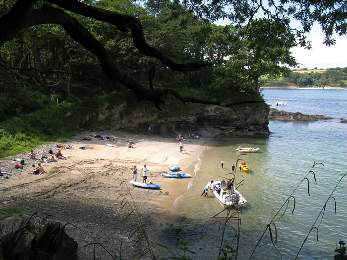
One of the many beaches on Helford River's southern shore.
The same beach as I pass it.
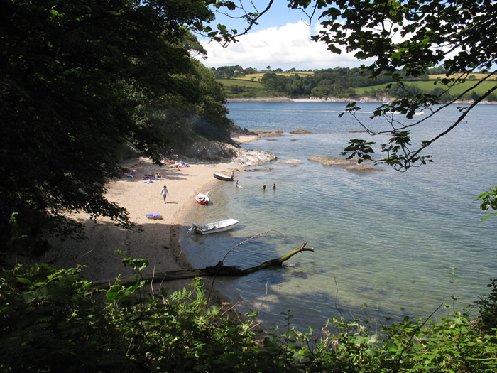
Another beach
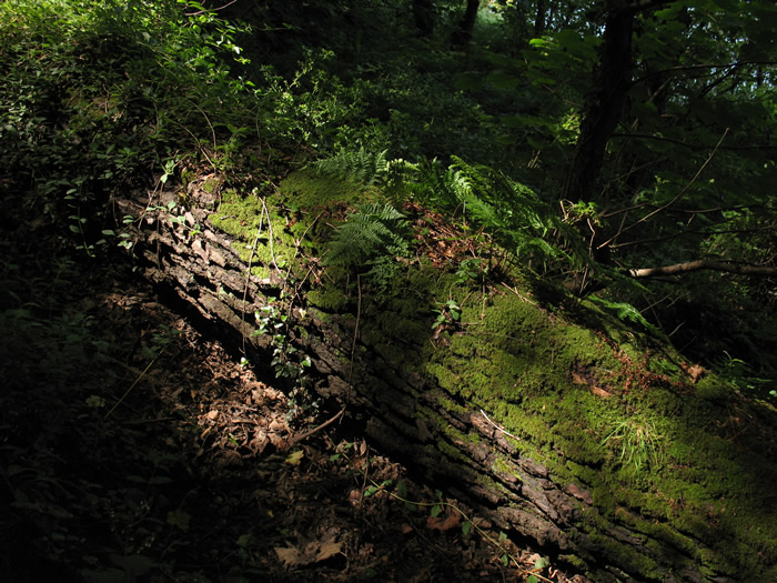
Fallen tree in dappled golden sunlight.

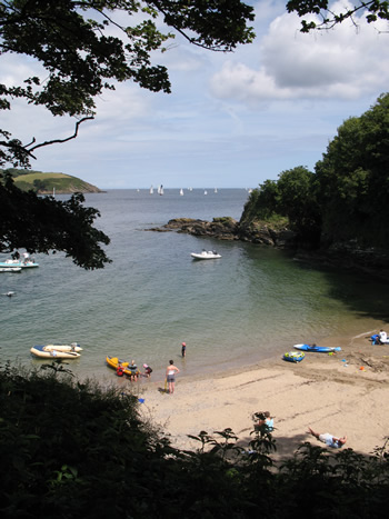
Looking across towards Helford Passage as I approach Helford.

Looking across at Helford Passage as I approach Helford |

Lane leading to Helford |
I eventually arrived at the car park where I had left the bike chained up to its fence. I was very pleased to still see it there. I decided to have a wander down to see what the village of Helford was like itself and I was glad I did even though it meant going downhill quite steeply to walk back up later. At the bottom of the hill was a lovely little river running down to the creek with a ford and footbridge to cross it. I crossed over the ford and turned right to walk along the opposite valley side. There was a post office and general store there with benches outside looking out over the creek. I bought a couple of cans of cold diet coke and sat drinking one looking out at the view. That finished I stowed the other can in the rucksack and made my wa back across the creek and up the hill to the carpark and the waiting bike. I was NOT looking forward to the cycle ride back to Coverack from what i had seen on the drive over there this morning!
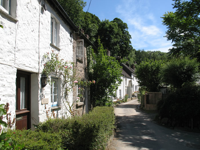
Helford cottages
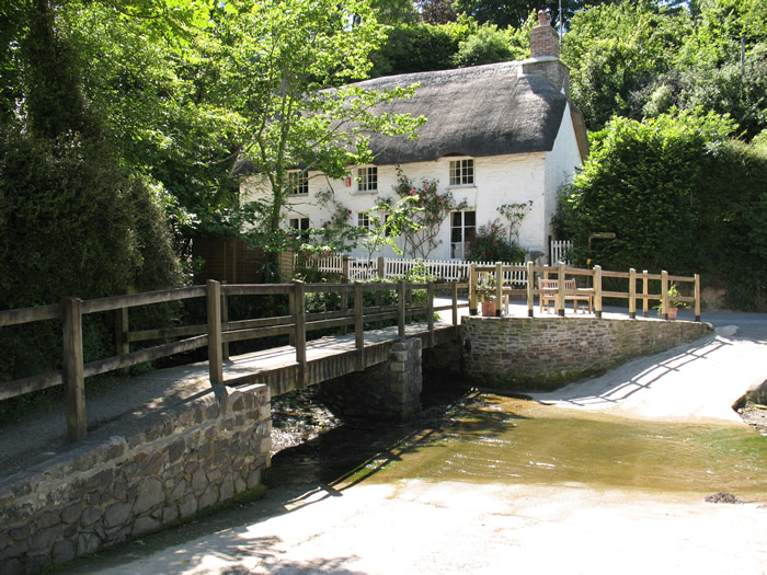
Bridge and ford over Helford village stream
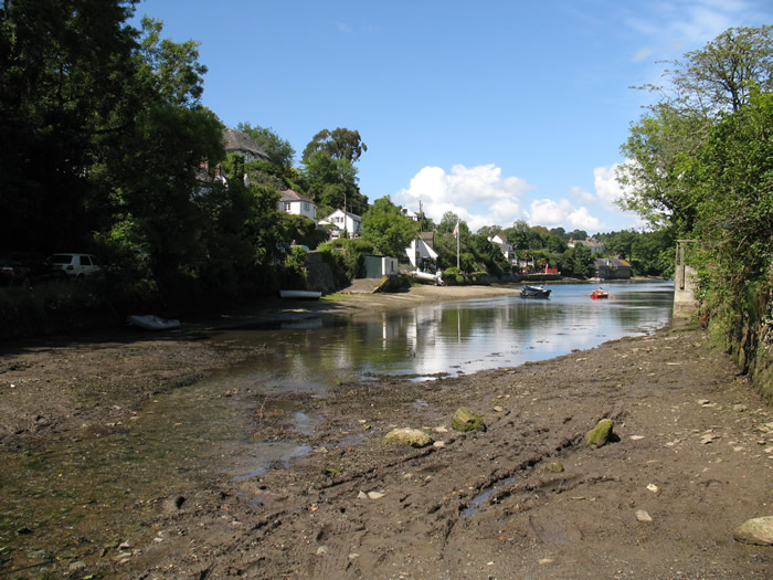
Looking along the stream out to the main Helford River
Looking across to Helford Passage, the start of tomorrow's walk, from Helford.
I didn't even attempt the hill up out of Helford and walked pushig the bike all the way up. At the crossroads at the top of the hill in Manaccan I went straight over and downhill quite steeply through the village. I was holding the map in one hand and so couldn't freewheel too fast down the hills as I didn't want to drop it especially as I was dripping in sweat and had slippery hands. The lanes are so twisty and turny and confusing I didn't want to have to keep stopping and taking the rucksack off to check the way at every junction! At the bottom of the hill I crossed the river bridge and turned right which of course was steeply uphill again up the far valley side. I walked up that hill pushing the bike again, panting like a steam train about to explode with torrents of sweat dripping off me. Very pleasant! NOT!
I got back on when the gradient lessened a little bit though I was making sure I used all the gears the bike possessed! It was a gradual climb all the way up to the road junction where I turned left and then immediately right. A gradual downhill section ensued through dark tree shadowed woods. Of course inevitably after the free ride there was a HUGE up. Not only could I not even attempt to cycle up it but I was wondering if I could actually walk up it. My lungs were about to explode and i had to stop two or three times to recover my breathing slightly before trudging on ever upwards again. I am really glad that no traffic arrived as the lane was so narrow that I am not sure it could have go by me and IIII wasn't going back down to the bottom to let them by!! At last I reached the top. On a big bend by a farm I rested the bike up a gate and had the other can of still cold diet coke. Steve texted as I was there to see how I was getting on and so I replied before setting off on my way again. There was one more small valley to cross, but then thankfully it was pretty much flat or severely downhill all the way to the waiting car in the carpark above Coverack. It was about 5pm when I got back to the car so a long day all in all, but I had made it and wasn't soooooo tired considering the very hilly cycle back.
It had been a really lovely day and a pleasant revelation. I would say that this section overall was one of the many highlights of the whole walk so far, partly helped by the glorious weather, the plentiful trees and the boat trip across the creek to St Anthony.
I got back to the campsite and had a brie and tomato baguette in rather stale bread now, but hey ho.. I am broke and it was filling. There was a barbecue at the barn this evening and so I went down there to plug the tiny laptop in that I had borrowed from work for the purpose of typing in the diary straight away to save me time. I didn't get it all done as I got chatting in the end. It was a pleasant enough evening. I went to bed about 9.30pm, tired but not as weary as I thought I might have been after a longer than comfortable first day!
Map of the day's walk:(click to enlarge)


Comments
Post a Comment