Day 22 - St Ives to Morvah - 12 Miles
I woke up early with rain on the tent. Yet again it proved to be only a shower. When I decided to get up and go for a shower at about 7am the sky was predominantly blue. The huge thunderhead and heavy rain dragging along beneath it could be seen heading inland.
It took forever for the shower water to heat up, so much so that I thought I might have to have a tepid one. At last though, the water became hot. For all its poshness the showers didn't have much room to store stuff to keep it dry! The radio in the washroom block informed me that the rain showers would become more pronounced throughout the day to become persistent rain by the afternoon.
I went back to the tent and managed to almost dry the towel in the strong breeze and sun, while I got the diary up to date before setting off for the day.
I was ready for the off by about 9am. It was novel to be not having to dismantle the tent. I'd eaten my cheese and mushroom pasty that I'd bought last night for breakfast while writing the diary. This still left me the broccoli cheese and sweetcorn one for lunch, but I did need liquid for the day so I at first set off up the hill as a glance at the makeshift map on the reception hut of the site seemed to indicate a shop up that way, but after walking a couple of hundred yards I'd not come across one, so I headed back down the road to the Newsagent I'd walked by before. I bought a couple of bottles of diet coke - not really very much for a strenuous day that the guide book described ahead - especially for a drinkaholic like me! I wasn't expecting blazing sun today though - the forecast I'd heard while showering seemed already to be coming true - the sun was becoming hazy as the high cloud was blown in.
As I'd walked this far down the hill to the Newsagents, I decided to carry on down and rejoin the official coastal route at the western end of Porthmeor Beach.
I have to say that without the rucksack I was tired even now - all my limbs ached with three hard days of effort. The only improvement was NO pain on the shoulders and a little less lung and heart straining on the hills. The blisters between my toes and the balls of my feet were less painful than I'd expected though. I was still aware of the pain, but the night's rest had seemingly done me good.
I felt a bit of a twit on my walk out to Clodgy Point - the first low headland of the day - clutching my day's provisions in a co-op carrier bag. Day tripper or what!?!

Looking back across Porthmeor Beach at St Ives Head as I walk out towards Clodgy Point.

The low headlands ahead as far as Hor Point as I round Clodgy Point.

Looking ahead from Hor Point. |

Beach almost exposed near Hor Point. |
I acually became quite euphoric as I was walking along the section of path past Clodgy Point. The guide book had promised quite awkward walking for the day and so I expected progress to be slow as I negotiated boulder strewn and boggy sections of not very well trodden path. In fact with my vastly reduced weight today I could leap about from boulder to boulder with the greatest of ease and progress was much faster than I'd anticipated. Coupled with this the sky was now clouded over but the cloud was high and milky and I could still feel the heat of the sun shining through it. It seemed the persistent rain was still some way off? I'd not fixed a firm end point for the day's walk. I would just get as far as I could, tiredness, blisters and rain allowing. I was armed with the bus time table and so knew what time it would pass me by at any point along the day's route. At this point I was even thinking I could manage to get as far as Pendeen, as I was still feeling sprightly and the weather looked promising.
After going through a rather oddly placed squeeze stile at Pen Enys Point, there were many oddly placed mini picnic tables and lots of signs with flora and fauna that you might see along your walk. I can only assume that the local landowner had decided to make circular walks and nature trails over the clifftops that he owns and loves? All a bit odd and sort of gave this section of the walk a spoiled theme park feel!?

Incongrous and out of place squeeze stile at Pen Enys Point.

Looking down at tiny a cove standing on a picnic table just after Pen Enys Point.

The walk between Pen Enys Point and Carn Naun Point ahead.

Looking back to Pen Enys Point as I approach the trig point on Carn Naun Point. In the far distance two days walk away Godrevy Point and light house, right across St Ives Bay.
A sign as I'd joined the footpath back in St. Ives by Porthmeor Beach had informed me it was 6.5 miles to Zennor. Despite my tiredness, I'd expected there to be no problem in covering this distance in about 2 hours, especially as I had very little weight to be carrying today.
The path soon conspired to tire me out though.... there was quite a lot of gentle up and downing and the rocky 'path' underfoot required quite a lot of concentration. I passed the trig point on Carn Naun Headland, about the half way point between St Ives and Zennor. Hmm.. I was already tiring, though going a fairly brisk pace compared to normal.. maybe I would certainly have to revise my making it as far as Pendeen as I'd been imagining would be possible not far out of St.Ives.
I passed the trig point and then headed slightly inland to cross a stream before heading back out and descending all the time to round the end of a headland with the rocky reef of The Carracks lying just out to sea off its end. I past a few people sitting here looking out at the reef with binoculars. It was then a gradual climb to round Mussel Point and at last catch my first decent glimpse of Zennor Head, still looking quite a distance across a rocky bay.

The Rocky Reef of The Carracks. |

Crossing one of the many gurgling streams of the day - between Carn Naun Point and the Carracks. |

I have descended quite low around the headland with The Carracks at its end. Just poking out behind Mussel Point in the foreground is the extreme end of Zennor Head at last and beyond that Gurnard's Head.

As I round Mussel Point at last Zennor head comes into view though I still have a good way to walk around Wicca Pool and then Pothzennor Cove! Just poking out from behind the distant Zennor Head is the even more distant rocky point of Gurnard's Head.
I set off from Mussel Point around the back of a circular rocky bay called Wicca Pool. The granite rocks around here were beautiful and covered in light green tufts of lichen. The sea was crashing on the rocks below. I'm not sure how different the scenery would have been if the tide had been out? Are there rocky beaches exposed here at low tide or does the tidal difference make little impact on the view?

The way ahead around the far side of Wicca Pool. Zennor head just poking out from behind the small headland in the foreground. |

Looking back at Mussel Point as I round the back of Wicca Pool. |

Close up of the lovely granite rocks at the back of Wicca Pool.

Having rounded Wicca Pool Zennor Head is still a good way ahead!

Looking back across to Mussel Point and the Carracks as I almost reach Zennor Head at last!
I finally made it to Zennor Head, feeling quite weary! The clouds overhead looked a deeper grey and more threatening. I was in two minds as to whether to call it a day, already having done the 6.5 miles to here, especially as there was a museum and a pub in the village of Zennor to pass the time of day while waiting for the bus?
It seemed a little silly to not take more advantage of not having to carry the rucksack today though? So with a last glance at the darkening skies I crossed my fingers and set off further around the coast rather than take the track to Zennor Village. I turned right off the track and descended quite steeply down overgrown steps to cross a wooden bridge over another stream gurgling its way down to Pendour Cove. The path then climbed gradually around the back of another lower headland that split the bay in two with a nice almost circular bay on its far side, with a seal bobbing about in the waves below. I past a man and woman coming the other way at the top of the rise, before gradually descending again around the next headland.

At last I crest Zennor Head, the crashing waves of Pendour Cove below me and the low rocky protrusion of Gurnard's Head beyond.

The wooden bridge over the stream near Zennor.

The circular bay at the far side of the low headland in the middle of Pendour Cove Bay. The path ahead descends to go around the far headland.

I round the headland to get a good view of Gurnard's Head

Looking back at Zennor Head from half way along to Gurnard's Head.

Gurnard's Head close at hand now.


Looking back after rounding Gurnard's Head.

Porthmeor Point

Looking back towards Gurnard's Head before heading out to Porthmeor Point.

Looking back towards Porthmeor Point as I head in towards Porthmeor Cove.
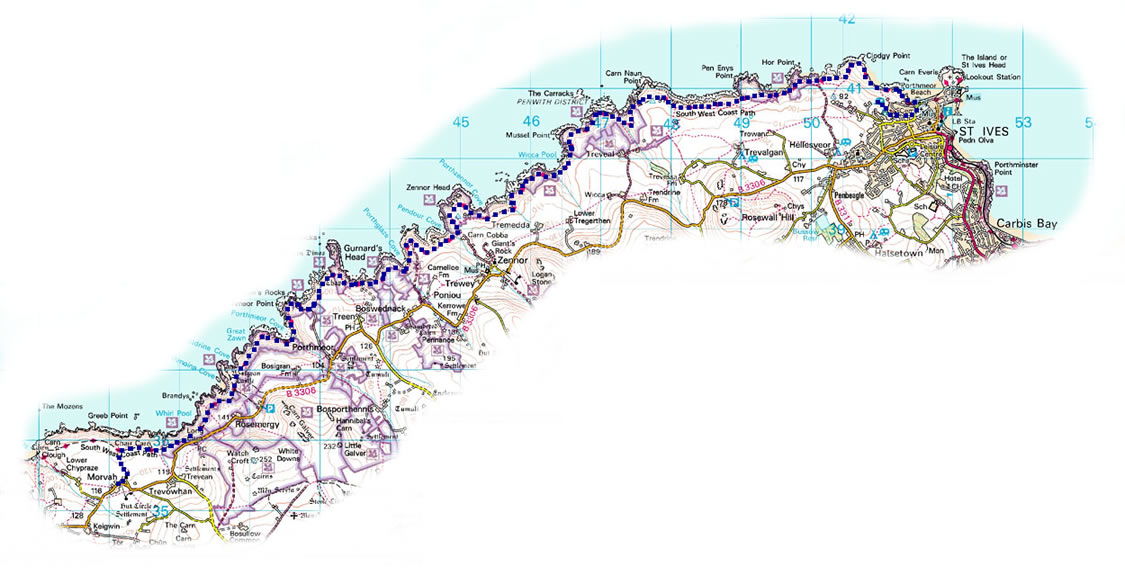
Map of the day's walk:(click to enlarge)


Comments
Post a Comment